Bandelier National Monument
Try as we might, Chris and I got a late start on the first day of our honeymoon. Our tire surprised us with a nice, little leak! Awesome! Also, family were starting to leave town. We ate a nice breakfast, had coffee, packed up, and headed out to Tesuque to explore some ruins.
Except... we could not find the right place to go and our phones weren't able to get a good enough internet signal to find advice on Google.
Plan B (you should always have a plan B) was Bandelier National Monument. Why? Ruins. But also it was supposed to be tarantula mating season and who wouldn't want to see migrating giant spiders? Exciting!
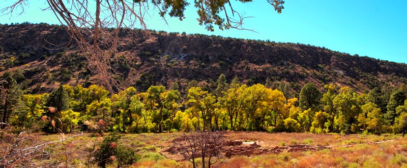
The drive from Santa Fe was fairly scenic. I took a number of photos from the highway.
 |
| Bandelier is further ahead! I can see it! Okay, maybe not but still. Here we go! |
I most enjoyed the foliage on the way up. I'm a New Hampshire girl and having lived in Texas since 2009 I truly do miss fall color. This part of New Mexico has a lot! It is mostly yellow, but I still enjoyed it immensely. When the shuttle dropped us off I suddenly realized that I forgot to pack an important piece of apparel; I was to travel New Mexico at higher elevations sans chapeau. Ugh! I attempted to shade myself while at Bandelier, and ultimately purchased a bucket hat at White Sands a few days later.
Bandelier National Monument is set up as a self-guided site with a number of hiking trails. Pick up your tour book from the visitor's center when you purchase your day passes. It's just a buck. As you walk the trails you'll encounter numbered stops that correspond with labeled items in the tour book. You'll learn all about kivas, cliff dwellings, and the people who used to live within the area they now consider the monument.
Here's some quick info from Wikipedia:
Frijoles Canyon contains a number of ancestral pueblo homes, kivas (ceremonial structures), rock paintings, and petroglyphs. Some of the dwellings were rock structures built on the canyon floor; others were cavates produced by voids in the volcanic tuff of the canyon wall and carved out further by humans. A 1.2-mile (1.6 km), predominantly paved, "Main Loop Trail" from the visitor center affords access to these features. A trail extending beyond this loop leads to Alcove House (formerly called Ceremonial Cave, and still so identified on some maps), a shelter cave produced by erosion of the soft rock and containing a small, reconstructed kiva that hikers may enter via ladder.
And additional history (also, Wikipedia):
Human presence in the area has been dated to over 10,000 years before present. Permanent settlements by ancestors of the Puebloan peoples have been dated to 1150 CE; these settlers had moved closer to the Rio Grande by 1550. The distribution of basalt and obsidian artifacts from the area, along with other traded goods, rock markings, and construction techniques, indicate that its inhabitants were part of a regional trade network that included what is now Mexico. Spanish colonial settlers arrived in the 18th century. The Pueblo Jose Montoya brought Adolph Bandelier to visit the area in 1880. Looking over the cliff dwellings, Bandelier said, "It is the grandest thing I ever saw."
It is stunningly quiet within the park.

There are a lot of steps and ladders to climb, and holes to look into.

Nature can be found in every little crevasse.

As far as kivas go, this is the largest we saw while on our exploration of New Mexico.

I loved these whispy stalks. Probably spent a good 15 minutes trying to focus on them correctly.

And who can beat this view? Just stunning.
There are a handful of trails for varying levels of difficulty. For a longer hike, start at the Juniper Campground and travel the Frey trail. It is about 1.5 miles and leads to the visitor's center. The Main Loop trail starts at the visitor's center and is approximately 1.2 miles. If you do both, you'll be looking at about 3 miles of hiking, however, there are trails that are longer than that, for those of you more interested in a more significant workout.
Chris and I finished our day at Bandelier by taking the "natural trail" portion of the Main Loop back to the visitor's center. We were determined to encounter an Abert's Squirrel. Every now and then we heard rustling so we would stop and search the fallen trees and brush for any sign of life. By the time we reached the foot bridge that lead to the parking lot, our hearts sank with defeat. But then we saw one! It skipped back and forth between trees as we chased it from a distance.
All in all, Bandelier National Monument is a great, family-friendly destination that's excellent for beginning explorers. Just remember to bring a hat for maximum comfort. Wearing layers is a great idea, too, because the change in elevation can make it warmer or cooler higher up depending on the amount of sun, the season, etc.


Comments
Post a Comment