Hiking the Violet Crown Trail
Austin recently opened a new portion of the Violet Crown, a trail which winds along through the Austin Greenbelt. A couple of weeks ago, Chris and I visited for the first time.
Visitors should note that the new trailhead does not have its own parking lot. You're advised to park at a nearby shopping plaza. Get directions to 4970 W Hwy 290 and park in the Spec's lot close to the frontage road. The trailhead is just slightly east from there on foot.
This is what the entrance looks like. You can just barely see it from the frontage road.

You're welcomed by a switchback just past the entrance. The trail is well shaded and quite woodsy.

Near the 4.5 mile marker you'll find an intriguing cave to look at.

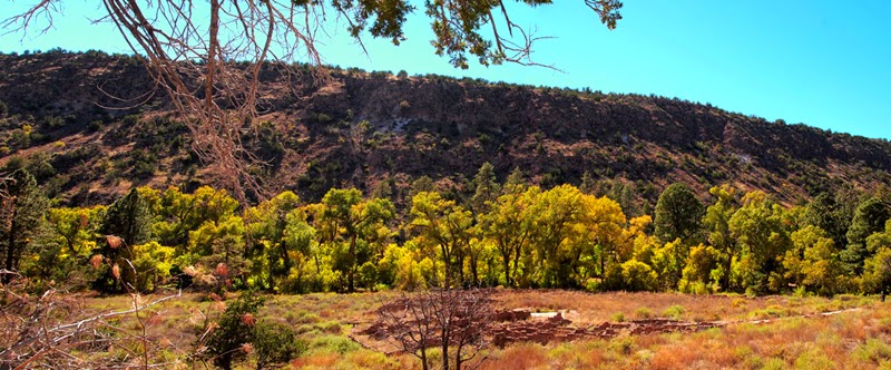
The terrain is on the rocky side but the beautiful bluffs give you something to look at as you slowly make your way over the sometimes jagged rocks.


Even though the trail winds through an area of the city that is quite populated, you will still encounter flora and fauna. I particularly enjoyed this plant, whatever it is.

According to Foraging Texas (one of my favorite blogs) these little purple gems are called American Beautyberry. They are technically edible but can cause stomach upset to some. The author recommends only having a few at a time... I think I'll pass. Oh, they also repel mosquitos.

If you hike this portion of the trail to the Loop 360 trailhead and back you will have gone approximately 3 miles. Our mileage trackers estimated just over 4. You can continue onward and follow the trail all the way to Zilker Park.
One week after our first hike on the trail, Chris and I returned where we left off. We parked at the Loop 360 Greenbelt trailhead and hiked until halfway between the Campbell's Hole access point and the end at Zilker Park. I didn't take photos this time, but I did shoot video. So, if you'd like a tour of that portion you can watch that below, or open it in a new window by clicking here.
First time visitors should note that the trail is not well marked. You can and probably will get turned around on your first trip. There are usually so many people there, though, someone more experienced can give you directions back to your destination.
Unfortunately, Google has not been updated with the newest portion of the trail. I created a map to give an approximation of the route the trail consists of, for those who are curious!
The two of us have been increasing our miles each week to work up toward a trip to Big Bend in the spring. We haven't decided where to go to next weekend but we may have to venture outside of Austin to find an area that meets our distance requirements. Until then, 'ta!


Comments
Post a Comment